There are 2 basic types of Volcanoes - Stratovolcanoes and Shield volcanoes. Technically, there is a third. It is a hybrid of these 2 - a Composite Volcano.
Stratovolcanoes have the classic "volcano look" - kind of like a cone with the top cut off of it. This is because the lava (it's called "magma" while still in the volcano and "lava" once it comes out) is thick, so it runs down the sides of the volcano more slowly and has time to cool and begin to harden on the way down. It's kind of like a candle in a way. The wax keeps building up and up on and around the candle as it cools.
A Shield volcano doesn't typically get as high as a stratovolcano because the lava is thinner and "runnier." It tends to flow more quickly and not build up as much because it just keeps moving. It more easily obeys the law of fluid dynamics - "Liquids seek to find their own level."
Composite Volcanoes result when the magma inside the volcano's cauldron changes chemically and is thicker at times (tending toward stratovolcano magma) and thinner at other times (tending toward shield volcano magma).
The Cascade range of Northwestern America is part of the Pacific Ocean "Ring of Fire." This ring of fire is caused by the fact that the "Tectonic Plates" which float upon the liquid core of the earth are moving. This causes them to collide and crash. Some of the plates are pushed UNDER other plates. This is called a "Subduction Zone." HEY! YOU IN BACK - WAKE UP! THIS WILL BE ON THE TEST!!
Anyway, you know how your hands get warm when you rub them together? This is because of friction. Friction generates heat. Now, take something as large as the floor of MOST of the pacific ocean and SHOVE it underneath of the state of Washington, Oregon and Northern California. What happens - The land that is Western Washington, Western Oregon and Western Northern California gets pushed up. This PUSHED UP part is called the Cascade Mountains. Also, LOTS AND LOTS of heat is generated by the friction caused by all those plates of earth rubbing against one another. It gets so hot that the actual rock itself begins to melt. This melted rock collects in fissures in the ground and causes pools of melted rock (magma). Eventually this pool grows and just like that ZIT you had at the end of your nose at 16 it POPS! VIOLA - a volcano is formed as this magma under pressure erupts out onto the land as lava around the crack. If it is thick lava it begins to build a stratovolcano. If the magma is thin it begins to spread out on the land and forms a shield volcano.
We drove Thursday from Weed, California (where Mount Shasta is) to Portland, Oregon. During this trip we saw numerous volcanoes. I wanted to share some of those pictures with you in this blog post.
First another picture of Mount Shasta:
Next Mount McLoughlin:
Next is the BACKSIDE of Crater Lake (that a one time was Mount Manama). This is called "Mount Scott":
Next was "Three Sisters." This is three volcano "vents" probably from a very large magma chamber. Two of them are stratovolcanoes and the third is a composite:
Unfortunately, we couldn't get a really great shot of these three beauties. They are behind a lot of trees as you travel on US Hwy 97 north, through Oregon. Since we were towing our car behind the Trekker, we couldn't just pull off on any road we wanted to go get a great pic. It's tough to turn around a 64 foot vehicle.
Next up was Mount Jefferson:
Next is Mount Hood the highest of all of Oregon's Volcanoes:
Finally as we approached I-84 at the North of Oregon along the Columbia River we could see Mount Adams ACROSS the river in Washington State:
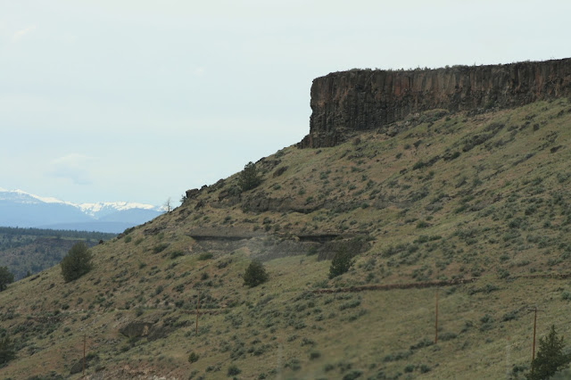
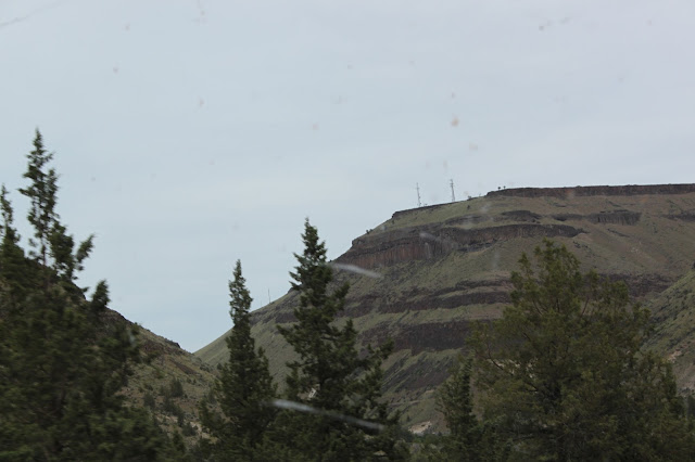
A couple of more pictures from a volcanology perspective. Coming toward the north of Oregon from the south out of Madras you come through the most beautiful Basaltic Lava flows. They are hundreds of feet thick and look like the Badlands of North and South Dakota. Mesas rise from the floor of the landscape. Butte sink down INTO the landscape. These were buttes.
Each"Layer" is represented by a separate dark set of cliffs. In the second from the bottom you can see a single flow on top that is probably 100 feet thick and a darker color than the ground under it. In the bottom picture I can count at LEAST 7 separate flows of lava indicated by the different dark bands with an angle and grass marking the boundary.


No comments:
Post a Comment